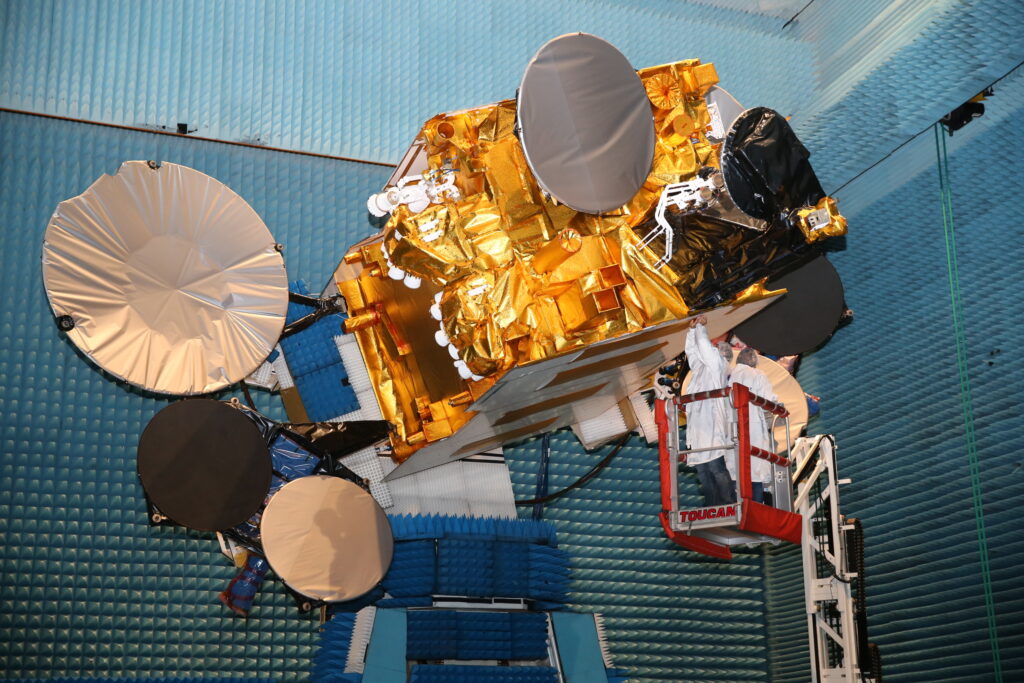
On January 25, 2018, the NASA Global-scale Observations of the Limb and Disk (GOLD) mission was launched on board a commercial satellite as a hosted payload.
The host satellite, SES-14, moved to its final destination in Geostationary orbit (GEO) in October of that year, where it became operational, sending important imagery of the Earth’s upper atmosphere to researchers at NASA and the University of Colorado’s Laboratory for Atmospheric and Space Physics (LASP) courtesy of the GOLD payload.
In the six year’s that the GOLD mission has been operational, it has witnessed impressive geomagnetic storms caused by solar storms, and sent back imagery to Earth that was previously unobtainable for researchers. This has led to multiple published studies and the potential for better prediction of space weather, which can impact satellites and other systems on Earth.
To learn more about the GOLD mission and what it has accomplished in its first six years in operation, we sat down with Dr. Richard Eastes, a Research Scientist at LASP, and one of the driving forces behind the GOLD mission.

Dr. Richard Eastes: The GOLD mission is a NASA mission of opportunity. GOLD stands for Global-scale Observations of the Limb and Disk. The limb is just the horizon. The disk is the view of the Earth that you get when viewing it from GEO. I would assume your readers have all seen NOAA satellite images from GEO, that’s the disk.
The existing views that we get of the disk essentially cover one hemisphere. More accurately, they probably cover about a third of the disk. Including the limb – the horizon – as well, about half of the Earth is covered by GOLD’s observations.
For this particular mission, we’re looking at the upper atmosphere, above 75 miles or 120 km. Traditionally, we have studied these areas and the effects of space weather using imagery from satellites in low earth orbit (LEO). But that’s a very restricted view that limits how often you can image any one particular area or anomaly.
If we identify a point of interest and image it from LEO, it could take upwards of 12 to 24 hours until we can image it again. Atmospheric changes can happen quickly, in only an hour. For us to understand what is happening and see any changes as they occur, we need the ability to take a sequence of images. This allows us to track changes more effectively.
We’ve studied the upper atmosphere’s climate extensively. But when we try to go beyond the climatology, that’s the seasonal changes, there’s difficulty in understanding the short-term changes. That’s especially important for space weather, and that’s the type of data you need to really make progress beyond the climatology we have now.
GSR: How does GOLD get that information? What is the payload comprised of, and what does it do?
Dr. Richard Eastes: The GOLD mission essentially involves launching an instrument into orbit. That instrument includes two cameras that are capable of what we would call spectral imaging. That means we can separate the different wavelengths of light in the images, and we can look at different emissions, or light, from oxygen and nitrogen in the upper atmosphere.
With the GOLD instrument, we can see where light from the Earth’s atmosphere is coming from and how that light is stimulated by the short wavelength radiation in the Sun, and also by the aurora.
These types of emissions are what we’re looking at. We’re looking at that light and those emissions to help us understand how the upper atmosphere is changing. So, by looking at the different colors – essentially our wavelengths of light – we can understand what the composition of the atmosphere is and how that’s changing.
In comparison to previous missions, GOLD is unique in its ability to image the disk and see the temperature. By combining the data coming from GOLD, we can get a much better idea of what is occurring in the upper atmosphere.
Since the GOLD instrument is in GEO, we can continue to look at the same locations and see how these measurements and data change over time. We can image rapidly, in less than half an hour, and see those changes in real time versus having to come back the next day. That’s massively important for gaining a better understanding of space weather and its impact on our Earth.
“The more we observe with missions like GOLD, the more we can build models that enable us to predict the frequency and severity of solar storms and geomagnetic storm events…these models will enable us to identify when a geomagnetic storm is coming, and how serious it will be, so we can prepare accordingly.” – Dr. Eastes
For example, there was a massive geomagnetic storm this past May. That was an incredible opportunity for GOLD to shine, and for its findings to stand out. We were able to sit there and watch how things change in the space environment, or how the space weather changed as it was happening. That’s something we haven’t been able to do before for the upper atmosphere.
GSR: How was the NASA GOLD payload placed in orbit? Did NASA launch its own purpose-built satellite for the GOLD mission?
Dr. Richard Eastes: I mentioned that GOLD is a mission of opportunity for NASA. That effectively means that the instrument is being flown on a satellite that serves another primary purpose. In the past, that usually meant the satellite is being flown for other scientific missions and purposes. In fact, missions of opportunity usually have some connection to the other scientific missions of that satellite.
However, GOLD is somewhat different in that it’s being flown as a hosted payload onboard a commercial communication satellite operated by SES.
GSR: Why was a hosted payload chosen for this mission?
Dr. Richard Eastes: Ultimately, pursuing GOLD as a hosted payload made financial sense. It was significantly less expensive to launch GOLD as a hosted payload than it would have been to launch it into orbit ourselves. Even launching satellites into LEO is expensive, and GEO can cost three or four times what a LEO launch can cost, so it would not have been financially viable to launch GOLD if we had to launch it ourselves.
Working with SES on GOLD has been an excellent experience. They have decades of experience flying satellites in GEO, and their satellites are highly reliable. Their knowledge of operating satellites enables us to simply give them a set of commands, which they upload to the spacecraft, and we can be confident that everything is done correctly. They then reliably deliver all data from GOLD to us at LASP.
I think the science community is impressed with what we’ve what we’ve been able to do, and how much we’ve been able to do by working with a commercial company and launching a hosted payload.
GSR: Was the process of launching a hosted payload difficult or challenging in any way?
Dr. Richard Eastes: The relationship wasn’t always without its challenges. There were certainly speedbumps and roadblocks that needed to be navigated – especially when it came to schedule. Candidly, commercial companies are used to operating much more quickly than science missions.
Thankfully, SES was able to get us involved very early in the process. This gave us an excellent picture of what was happening. They also took the time to meet with us and discuss the details. They brought in the people that could answer our important questions – including questions about interfaces and ensuring that our payload would interoperate with the satellite.

In fact, when we told them about challenges that we were working through with the payload, they often would give us suggestions and provide even better solutions than our team could identify. One example involved the power supply. There was some discussion about how we could adapt to the voltage of a commercial satellite. SES simply offered to provide us with the 28 volts that were needed to power the payload, and solved the problem for us.
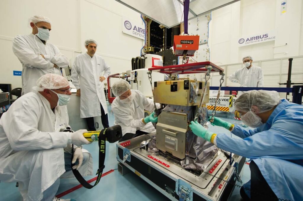
Even during integration, we had someone there with the spacecraft vendor fulltime to help with monitoring the spacecraft and monitoring our instrument. If the vendor needed to move the payload they wanted to ensure t it wasn’t mistakenly damaged so they had someone from our team ensure their activities wouldn’t cause a problem for us.
GSR: How long has the GOLD payload been delivering data to NASA and its mission partners?
Dr. Richard Eastes: Following launch, it takes a while for the satellite to get to GEO and begin operating. So, GOLD came online about six years ago this month (October of 2018). That’s when we started making our first observations.
At that time, the sun was going through what we refer to as solar minimum. The sun goes through an 11-year cycle, and it was solar minimum when GOLD came online. We’re about at a solar maximum now. So, we’re really halfway through one solar cycle at this point.
We’ve been delivering data that entire time. Throughout these six years, we have been making daily observations – multiple scans on the day side and multiple scans on the night side of each day.
GSR: There were recently two studies published based on observations from the GOLD mission. The first looked at changes to the ionosphere due to a massive geomagnetic storm. What causes storms like this? What impact did this storm have, and why was it newsworthy or significant?
Dr. Richard Eastes: The sun sends out clouds of plasma that we call coronal mass ejections. And when one of those hits the earth, it can generate and deposit a lot of power in the Earth’s upper atmosphere. That power gets transmitted into particles that start flowing, which generates currents and magnetic fields.
While this disturbs the Earth’s magnetic field it also produces the aurora, which was one of the results in this most recent May storm. People saw the aurora really far south, potentially as far south as Florida. I even heard some reports that it was seen as far south as Puerto Rico. Typically, you must go up north to places like Iceland to see it. This was a very rare occasion where people much further south could simply walk out in their backyard and see the aurora.
But these changes don’t just cause the aurora. They also can interrupt HF communications that are used for numerous applications, including airplane communications. It can also interfere with GPS systems. I heard reports that during the May storm, there were numerous farmers in the Midwest who rely on GPS for precision agriculture to ensure chemical and seed distribution is done properly that couldn’t plant their crops during the storm.

There are so many systems that rely on GPS today. All of these systems – even automated construction equipment that is navigated by GPS – experienced outages and other disturbances as a result of this May storm.
GSR: In the second study, GOLD identified how a wave of plasma from the sun impacted the Earth. What role did GOLD play in identifying this? What impact did this wave of plasma have?
Dr. Richard Eastes: We don’t really see the plasma directly from the sun. What we see is the effects of that plasma when it reaches Earth. During the May event, we began our observations on the night side and then continued into the day side. We saw some things that we’ve never seen before.
We were able to get a picture of the neutral atmosphere and the ionosphere. We learned about the temperatures in the atmosphere and how that varies. We witnessed electric fields causing some of the nightside atmosphere to move at rapid speeds – as high as 400 meters per second – towards the poles.
It’s important to identify these changes because changes in the upper atmosphere have widely distributed impacts. While Earth’s weather is more localized – a storm in the Atlantic Ocean might have no bearing or impact on the Pacific Ocean – space weather changes impact the entire planet.
GOLD was essential in identifying these changes because of its ability to take images of an area at 15-minute intervals. When we were relying on LEO satellites for observation of the upper atmosphere, we could only generate an image every 12 to 24 hours. A lot can change in that time, and you lose the ability to see it changing and identify what’s happening and why.
Because of GOLD, we were able to sit there and watch things develop and see how the upper atmosphere changed.
GSR: Why are these new reports and findings important for NASA? Will they enable us to better predict things that could impact daily life on Earth? Are there impacts of these events that could be felt by civilians?
Dr. Richard Eastes: The May geomagnetic storm event was significant and impactful. But it wasn’t the most significant storm that our Earth has experienced. Back in 1859, the Earth experienced the Carrington Event, the most intense geomagnetic storm in recorded history. It was 10 times the size of the May event.
The Carrington Event impacted the Internet of the day – the telegraph system. In fact, I even heard stories of telegraph stations catching fire as a result. Imagine what a solar storm like that could do to our modern, technology-reliant society.
We learned from the Carrington Event. We were able to more accurately predict the May solar storm event, and we were able to prepare for it. We were prepared enough that it didn’t cause a significant number of serious problems.
It’s important that we see the effects, how things are changing, and how the Earth’s upper atmosphere is responding, because that’s where a lot of the currents are flowing. Seeing what happens in the upper atmosphere in advance of an event like this, and during an event like this, allows us to more accurately predict future events. We’ll identify the precursors and be able to prepare for an event. We’ll also be able to more accurately predict the severity of an event.
The more we observe with missions like GOLD, the more we can build models that enable us to predict the frequency and severity of solar storms and geomagnetic storm events. Much like how predicting a hurricane and its path enables us to evacuate and prepare an area, these models will enable us to identify when a geomagnetic storm is coming, and how serious it will be, so we can prepare accordingly.
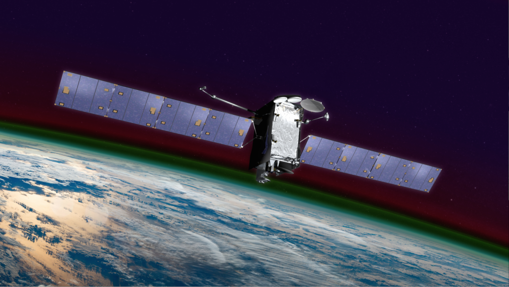
Feature image: Bands of colorful airglow are visible above the limb of the Earth in this artist’s depiction of GOLD on the SES-14 satellite. (Courtesy NASA GSFC)
